Inveterate dabbler in business, travel, gadgets & life

Bigbury On Sea to Salcombe on The South West Coast Path

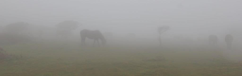
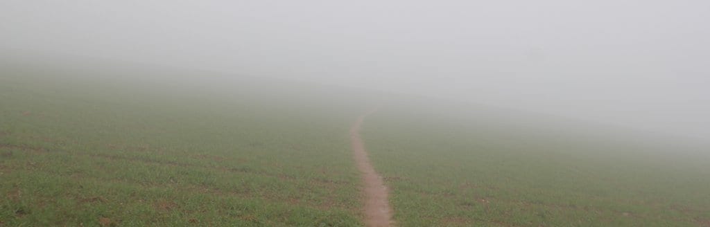
Today was all about the weather, there was little else to see due to the very low cloud. At Burgh Island on a foggy dayBigbury you couldn’t even catch a glimpse of Burgh island.

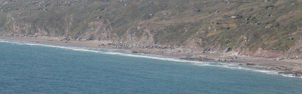
What I did see were the huge number of planning applications tagged to everything that couldn’t move, Cambridge may think it has a problem of over development but crikey these seaside towns are inundated with us rich oldies pouring millions in to get a sea view. My theory is that the eye / brain  seeks movement, hence a tiny few of us walk, the majority want to sit and watch the flicker of a TV set and those with the dosh want to watch the tides come and go 🙂

Waiting in the rainI finally reachedAt the Avon ferry after taking the wrong turn in  the farm at Mount Folly where I met the couple who I had met at Wembury, although unbelievably it was me who recognised them 🙂 plus a group of 4 lads all doing the path from Plymouth towards Poole. We were all getting a bit concerned as he didn’t show till 10.20 and the alternative land route looked a nightmare.

As the day went on the rain & squalls started, in Hope I hung around in the cafe, debating with myself wether to make it a short day.  The 4 lads marched past, the couple I noticed snook into the back of a taxi! The price the pub wanted, £60 for the night sealed it’s fate, I  soldiered on.

Fog is a funny thing 30 mins wastedAlong Bolberry Down it was horrendous, almost zero visibility heavy squally showers, the Scarpa boots leaking like sieves & sliding all over (well they are 4 weeks old!). around bolt head I got confused and ended up walking the same stretch 3 times, thus adding half an hour to the day. The Canon D550 became confused as well and and decided to stay on all the time!

Finally reached the outskirts of Salcombe where the YHA is but decided to continue up and down the hills that separate all the beaches and get into Salcombe proper. Where the nightmare of finding a room began. The pub wanted £70 for a room only! one house £60 for the room only, I phoned up another 5 all full/closed etc Finally Mike (who had tried to contact me all day but eh this is the UK mobiles only for the big townies)  came to the rescue and found me Ria View but with a small disadvantage of a late breakfast at 9am, so the Ria is where I’m at and very pleasant it is too.

I really can’t understand the mentality of folks, running a business with fixed costs, who would rather have nothing than say £40. Especially the pub who lost my evening trade too.

The photos are here, statistics here, and Everytrail below
Bigbury to Salcombe on the South west Coastal Path at EveryTrail


Noss Mayo to Bigbury on Sea on The South west Coast Path

Cloudy path

Philip at Worswell Barton FarmI awoke to the delicious smell of home made bread, a wholemeal loaf especially baked for me by Jackie, this combined with a fresh fruit salad with home made yogurt (Sally would really have loved) a bowl of steaming porridge plus two farm fresh eggs made a great start to the day. Which is more than can be said for the weather, totally foul, very low clouds squally heavy showers all made me seriously consider staying.

I started walking to the sonorous tone of a fog horn, that’s how low the cloud was 🙁 the squalls continued for quite a while, hence no pics for the first part of the day. I ploughed onto the dreaded River Erme crossing which can only be done +- 1 hour of low tide, which today was at 2.30pm. I arrived at midday and thought I would spend a, hour or so in the cafe – which of cause I found, after climbing up the hill, was closed. Thanks ladies at The Old School House!

Erme estuaryErme crossingI returned to the estuary and thought I would give it a try – when the stick started bending in the current, I beat a retreat and then spent time wandering up and down to find a crossing place to no avail. Eventually at 1.30pm I managed it with water up to nearly the top of my legs using the sticks to stop me getting pushed over. The river was really swollen due to the rains.

I continued on up & down several tortuous hills  all very slippery and very close to cliff edges with swirling cloud but fortunately the rain had eased off so I could see the edges, but I still fear accidentally throwing myself off…

THe interesting part today was reflecting on how The Barings lost all their money and hence  their huge estate around Noss Mayo by bad investments in  South America (Nick Leeson did it for them again later). Whereas The Flete Estate have hung onto huge tracts of land around The Erme with no housing development.( apart from a row of ugly coast guard houses).

Caravan parkI arrived in Bigbury on Sea via the mega holiday caravan site at Challaborough Bay where for less than £5000 one can be yours! How do they get planning permission for such favela type places?.

Bigbury on sea is in the throes of moving upmarket from thirties bungalows, like Marashina where I’m staying, to huge glass palaces.  The local hotels  refuse meals to outsiders, so it was back to the caravan site for my supper – in the rain again! Maybe next time after my bonds turn up trumps I will stay at the iconic Burgh Island Hotel across the sand spit from here. 🙂

Only 190 miles to go 🙂

The pictures are here statistics here and Everytrail, as always below.

Noss Mayo to Bigbury on Sea on The South West Coast Path at EveryTrail

Plymouth to Noss Mayo on the South West Coast Path

Naval ship

I woke up from a terrible nights sleep with a thumping headache feeling awful. I popped some Nurofen but realised I was probably suffering from dehydration 🙁  I went into Plymouth bought some new inner socks and a 2 litre bottle of carbonated water (Why don’t shops  /garages keep carbonated water in the chiller cabinets? ). I instantly drank 1 litre of it!

Mayflower StepsI reached the Mayflower steps in the harbour and saw the Mount Batten ferry, I succumbed and took the 5 minute ferry instead of walking the 7.5 miles around a very built up area.

I then started the day’s walking, marvelling at the huge blocks of stone that have been carved to act as way markers (till the money ran out at the top of Jennys Cliff).  I quickly reached a fine cafe on Jenny’s Cliff where I took a lot of pics for my sister Jenny 🙂 The footpath has been reinstated so The Guide is incorrect about using the road.

The walk from there was very pleasant, looking at the submarine and all the warships cruising around. Then on through the Heybrook Bay holiday home park and on to Wembury after which it seemed to take an age to the ferry at Warren Point which only runs from 3pm to 4pm. So just as well I omitted the 7.5 mile walk otherwise I would have got there to late!

After the 5min £2.50 crossing with the ferryman bemoaning how few passengers there were it became a lovely walk along the very scenic old  carriage way apparently buit by The Barings. and then back along the top to my lovely accommodation at Worswell Barton Farmhouse where Jackie made me feel very welcome. Their solar heated shower now takes first place in the most powerful one on my South West Coast Path walk 🙂

Later in the evening Philip ran me down to the Ship Inn in the centre of the delightfully named Noss Mayo village (apparently from the French word for nose). An excellent meal too

Weather wise it was a fine day with a bit of sun and no wind.

The pictures  are here, statistics here and Everytrail below

Plymouth to Noss Mayo on The South West Coast Path at EveryTrail

Looe to Plymouth on The South West Coast Path

Coastline

Another long day with just under 19 miles walked and 4780 feet climbed!

The Schooner Point gave me an excellent  breakfast, I particularly liked the way all the homemade items were labelled and the way the cereals were stored in cavernous glass bottles with ladles. Very tidy & brand less 🙂

Sand bully in operationSince I left early it was interesting to see the beach been cleaned with a miniature piste basher, I wonder if it has magnets in to grab all the money folks have dropped during the day. Climbing out past all the luxury homes I soon descended into the distinctly downmarket Millendreath with it’s boarded up entertainment complex’s and hundreds of small chalets. I pondered how places become like this? Did it start with a local parish councillor on the make…

Spiral of 7I then climbed up again  to the rather beautiful spiral cut into the grass and the poster with the mythology behind the number 7, making me think about the role of 7 in my life (born in the 7th month of the 7th year, 28 is 7 times 4…….. then descending through the beautiful woods into the remarkably naff beach cafes, no fancy cakes and china tea cups along the route for me today. then on through the Tregantle rifle ranges with a rather menacing warship lying offshore.

Jagged rocks Then to Cornwall’s answer to a shanty town, Freathy with its multitude of wooden shacks obviously built prior to the planning laws arrival. The road was getting busy so I descended onto the gorgeous beach, which you should leave  near the old boiler from  the wreck. However, in one of my more insane moments I could see a set of steps at the far end and decided to clamber around / over the amazing & dangerous jagged rocks, which at times seemed impenetrable. Reaching  the steps they turned out to lead to the rather exclusive and very private Pollawn Fort wedding centre which rather explained the skip full of champagne bottles. However, I wasn’t challenged so I snook out.

Cawsand beachThe walk continued through beautiful woods and countryside to the amazingly pretty Cawsand village which was in the middle of a May day carnival complete with Morris dancers and Navy wallahs wading in the sea. A Plymouth ferry arrived as I was on the beach so I skipped the last two miles to Cremyll and its ferry and hopped on.

I wandered up to Citadel Road, the b&b centre according to Mike and booked into Kynance House. Then went for a disastrous meal at Cafe Rouge in a distinctly uninviting deserted Plymouth centre.

All the pics are here and stats here, Everytrail below
Looe to Plymouth on South West Coast Path at EveryTrail