One advantage of the Chiltern Lodge is that they do breakfast from 7.45 so you can
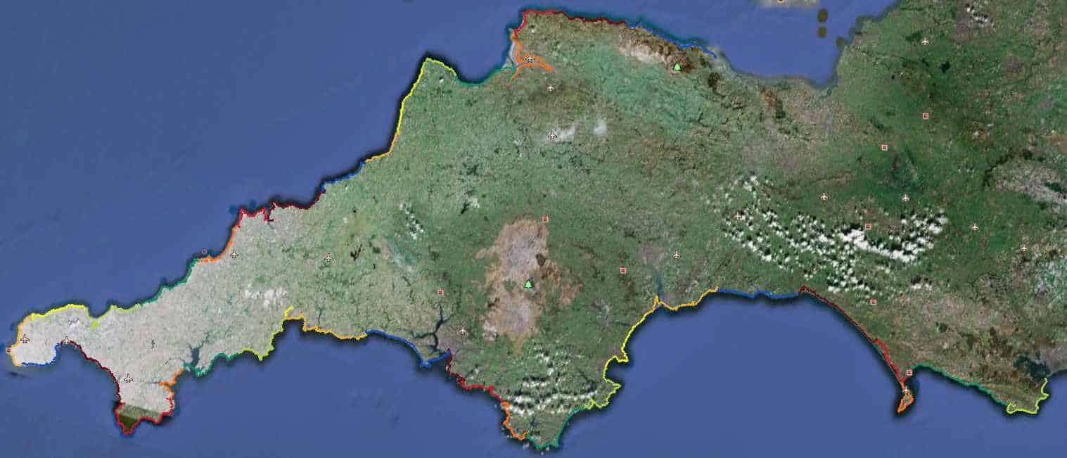
 escape get away early. So I was out on the road just after 8am. With it been an easy day, the guide said 16 miles to the end and ‘only’ 1768feet of ascent. I decided to do the decent thing and return to where I left the trail last night. As you can see from the gps trail it added a considerable amount to the day, that’s how good I am 🙂
It was a good decision, as you pass some interesting memorials and stone benches. Since this area is famous for the Purbeck marble. and also in the development of UK radar in the early days of the second world war.
 I quickly reached Durlston Park with a total surprise in the huge globe carved from stone in 1891, very surprised it didn’t feature in the coast Path Guide since it’s directly visible from the trail. I’m always astounded with carving, how do you create a perfect globe shape? Durlston is now a Jurassic Gateway centre, I can’t help thinking that a walkway carved with millenia over yards, with human’s scrunched into the final 1/4mm is a bit beyond the average kid. The one that does it for me is that the 100 foot high white cliffs are just dead creatures ( densely-packed shells of the freshwater snail Viviparus).
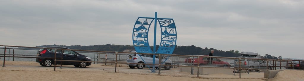
So onto Swanage and the very clever Trompe L’Oeil on a harbour building, the little museum was quite good too with it’s Titanic exhibition and film on the stone industry. But no time to hang about, I can smell the end.
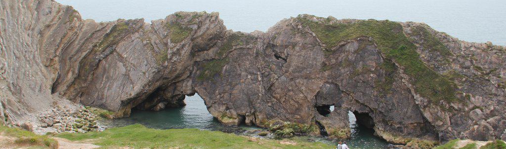
 Past the monument to Alfred The Great’s great battle with the Danes in 877AD, pausing for the best ice cream yet! honey & stem ginger 🙂 then on through more private chalets to reach the Old Harry rocks with their precipitous edges, Finally dropping down to the beach which had to have the very best National Trust sign ever! Oh, what fun I could have had if Sally, Liz & Chester had been there to pose naked behind the sign.
And finally rounding the corner on the beach, just missing the huge Condor Ferry boat, the end marker came into view 🙂

So that is it! 676 miles walked in 222 hours moving time over 40 days. and 1.5 million steps walked. Full round up in the next post.
A tip for other walkers at the end, book your train ticket from Bournemouth station not Poole as I did. You can catch the bus just off the ferry that takes you directly to Bournemouth station 🙂 It’s the same line as Poole anyway!
Photos of the final day here, trip spreadsheet here and Everytrail below.
Worth Matravers to South Haven Point on The South West Coast Path at EveryTrail