Inveterate dabbler in business, travel, gadgets & life

Day 5 Gonnehem to Fresnes Les Montauban

IMG_3180
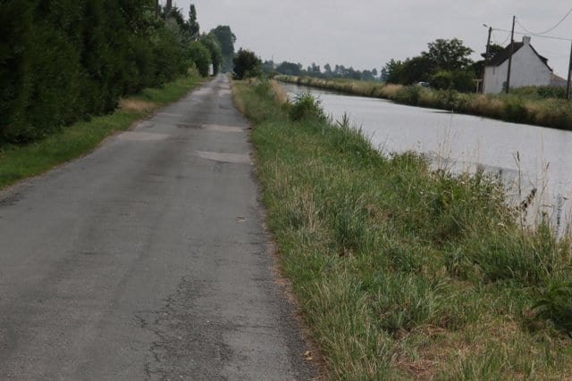
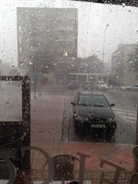
With great reluctance I departed from  Le Clos du Fouan  into the grey & wet morning. I headed back down to the canal, marvelling at the size of the barges, probably equivalent to half a dozen UK ones also on the distance between locks, this part of France is certainly flat. I left the canal at La Bassèe had a cake and coffee and then headed into the French road system. My carefully constructed route on Viewranger quickly turned to shambles when confronted by strictly no cycling signs and huge artics squeezing past. I hastily made another route which interestingly took me through all the ex mining village’s & distinctive conical pit tips.

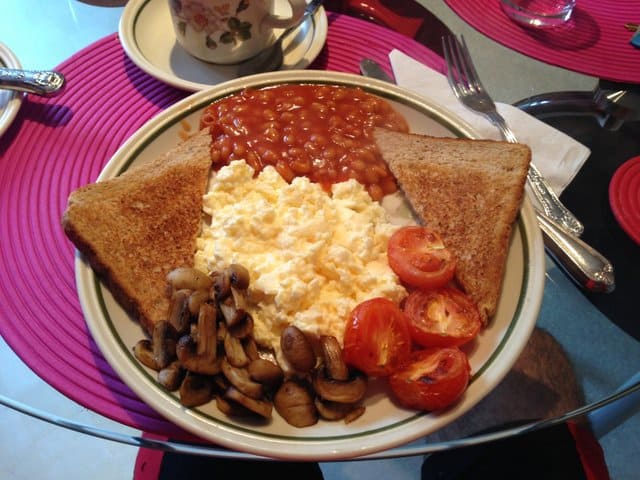
I tried to repeat last nights success using @aroundme all it came with is the L’Aquarium Hotel with it’s closed restaurant,  this poor motel styled hotel is rather cut off by a motorway, high speed train track and a dual carriageway. But once you have navigated in it’s clean with good showers.

I’ve spent the evening using Viewranger to edit tomorrows route using the Bing aerial photos as a background so I can physically see the towpaths, fields and absence of bridges.

Legs are starting to loosen up and Sally’s pressie of Endura overshoes certainly came in very handy preventing wet feet, until google maps had me going down farm tracks with deep puddles 🙁

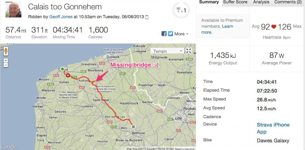
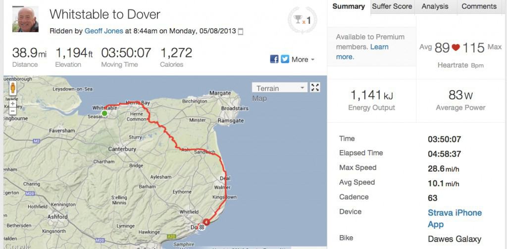
Here is the Strava result for the day:

Strava_Ride___Gonnehem_to_Fresnes_Les_Montauban

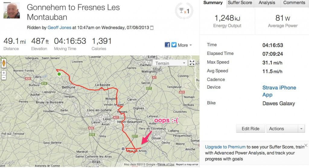
A short day of 49 miles of which 9 were messing about trying to find the hotel, incorrectly shown on Aroundme but correct on Google Maps.

The pics are here today.

Day 4 Calais to Gonnehem

After a dreadful nights sleep, what with the squawking seagulls (please remind me never to live near the sea!) and plumbing noises. It was straight off to SFR to sort out the bricked dongle. They eventually replaced it after everyone inspected it like some dead animal.

IMG_3160I started to follow the rather magnificent canal although it’s quite tiring making sure you are on the correct side and that the canal is going the correct way, you can see from the Strava data I failed at one point getting stuck in a Y junction.  I finally made it, very tired & down to Watten for a slap up lunch. Debating to myself whether just to let a train take the strain. Google maps failed again in the afternoon where the canal path was just not there!  making me use a main road in a procession of artics.

The iPhone app AroundMe came up trumps however with the gite for tonight. Le Clos du Fouan is excellent with a shower I could happily unscrew and take back to Cambridge except of cause Cambridge water is very hard. Unfortunately the local restaurant is closed Monday nights so it was off to Clarisse’s chippie wagon.

Another 57.5 miles done. Unfortunately the cadence meter seems to have packed up 🙁 but here is the Strava data:-

Strava_Ride___Calais_too_Gonnehem-2

The day photographs are here


Leaving the Country – Day 3 – Whitstable to Calais

IMG_5104After a most magnificent breakfast at the Oyster Guest House, unusually, in my experience, cooked by the landlady.

I started  the final UK leg to Dover, I opted for the scenic route to avoid Canterbury & the evils of the A290.

IMG_3133

The first part was on the Oyster Bay cyclepath, A REAL cycle path along the coast to Herne Bay then inland through delightful villages such as Preston finally arriving back on the coast at Sandwich. The ride along the coast here was pretty tough with a  10-15mph head wind. Then the monster climb from Kingsdown beach to St Margaret’s.

The descent into Dover was once again marred by the wretched Route 1 Kissing gates (although slightly larger this time) really pleased to be leaving those obstructions behind.

£20 later and I was grateful to be aboard the DFDS ferry to Calais, as the rain had started 🙁 I managed a lovely Facetime chat with Isla who enjoyed seeing the white cliffs of Dover from the ship 🙂

IMG_5108Now booked into the Hotel Pacific which I’m pretty sure is where I stayed last time.  Tonights Moule Marineres were made rather exciting as suddenly the heavens opened up with amazing ferocity . all we customers had to hang onto the awning to prevent its escape onto the English Channel.

Once again struggling to get internet access in France. I finally, reluctantly, decided to get the SFR Web Trotter dongle with a 4GB allowance to be used in 30 days. Lets hope it works, seems to be taking ages to charge up. The shop opens at 10am tomorrow…..

Todays Strava stats for the 39 miles (I did 3 more miles in Calais) are here:

Strava_Ride___Whitstable_to_Dover

and the days pics are here

Mega bike ride – Day 2 Euston to Whitsable

IMG_3105Today started with a very emotional Sally kissing me goodbye at Kings Cross, after our Pret breakfast. Not sure if the emotion was caused by the £22 single ticket fare to Cambridge (it’s only £15 the other way & the return is only £1 more).

After my previous fiasco navigating out of South London I decided to use the new bike mode in the iPhone Google Maps app. Obviously Google don’t expect you to be on the bike very long as it flattened the battery in less than 2 hours 🙂 and dumped me on the wretched  Route 1 Cycleway, Which sank to new lows today with the multiple kissing gates that aren’t  quite big enough for a touring bike and the keyholes not quite wide enough to take panniers 🙁 Ace design lads! Additionally for a fair stretch its a  very rough pathway and it takes you past the incredibly smelly sewage works.

A very hot & hilly day necessitating many stops at petrol stations to fill up with sugar water at roughly X3 the diesel price and offering considerably less calories. (petrol has 8 MILLION calories per litre).

IMG_5099After 78 miles with quite a bit on very  busy roads, I finally made it to Whitstable a town that loves its oysters and with remarkably few b&b’s. A lovely surprise was a skype call from Oliver, Ren & Stevie

Tomorrow its Dover & the boat ride to Calais.

This is my Strava data for today:

Strava_Ride___Euston_to_Whitstable