Inveterate dabbler in business, travel, gadgets & life

40 days of wear on Scarpa Hiking Boots

Final update! I returned the boots to Open Air who sent them onto Scarpa’s UK agent (Mountain Boot Company). on June 8th they refunded me the full purchase price with an admonishment from Open Air that they won’t supply me another pair of this boot model!

This an update to the disappointing saga of my  latest pair of Scarpa Terra GTX boots, purchased from Open Air in Cambridge, UK on the 7th April 2012 for over £120.

Scarpa Terra GTX Boots at 1.5 million steps 680 miles
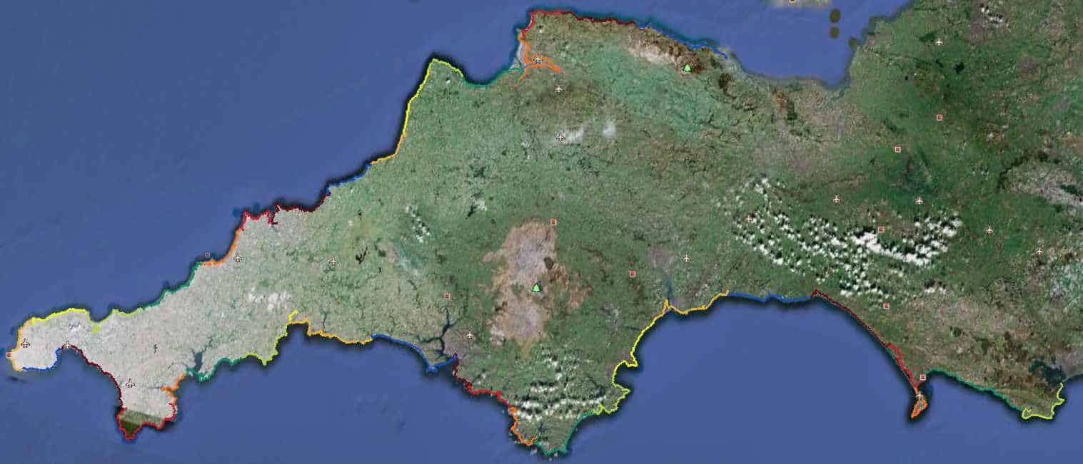
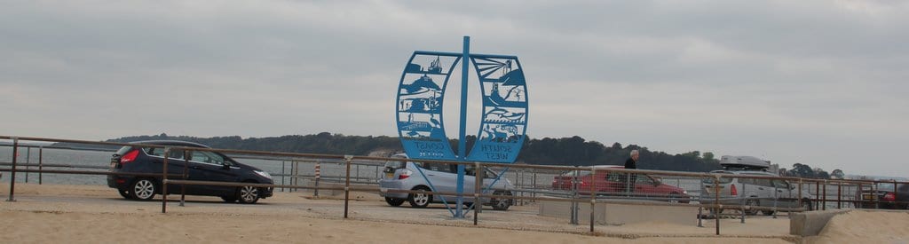
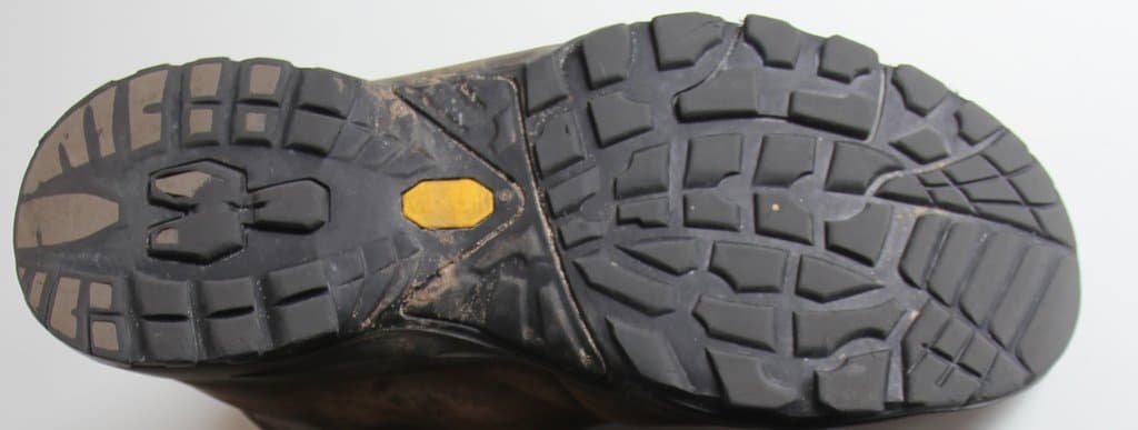
From my first post you can see the heels started to wear very badly after only 127 miles and started to leak water at 307 miles.  I’ve now completed the 676 miles of The South West Coast Path. This is a pic of the boots today after about 1.5 million steps or 680 miles (1000Km) or so. As you can see both heels are totally  worn down (making them lethal in wet conditions), the toes are also close to their limits. Most of the walking was over pretty soft terrain (you can see the rubber isn’t shredded at all).

Whilst away, I entered into some email correspondence with Scarpa which turned out very disappointing. Nathan Fullwood, Ast. General Manager of the UK distributors, The Mountain Boot Company, promised to call but none came 🙁  In an email to Open Air their response was:

“The wear rate of an outsole is linked to a number of factors including rubber shore. However Factors such as the midsole ( be it pu, Eva etc ) and the internal midsole ( texon, nylon internal board) will have a bearing even before one considers terrain, walking style and consumer abrasion.
The terra construction is overall designed to be light and cushioned, with an upper and sole that perform/ wear in tandem As the boot is close to impossible to resole effectivly. One could increase the durability of the sole by adding more rubber, but this would increase weight.
In our experience of the terra having sold over 50,000 pairs in the uk over the last 4 years, we are comfortable with its components and performance for its intended use. If we have seen a return on the product, it has almost always been linked to a more experienced and serious user expecting more from the product than it was really designed to do.
As such as per our initial feedback we would propose to trade your customer up into a product such as the ranger gtx or perhaps even a delta gtx. ” (my emphasis)

So they expect £120 to only buy you a pair of boots not designed for serious walking? Their website clearly says something different:

THE SCARPA® TERRA GTX WALKING BOOTS ARE IDEAL FOR HILL WALKERS LOOKING FOR COMPLETE WATERPROOF PROTECTION AND COMFORT

So it’s back to Open Air who say they will return them to Scarpa for me, maybe I should get the family Italian connection’s to give someone at Scarpa head office a call 🙂

It’s amazing to me that no one seems to make boots with easily replaceable heels, I would have thought they could be made to bolt on, rather like the bindings on my snow board. then I could carry spare heels on my trips 🙂


Postcard index for my South West Coast Path Walk

Last night the Jones design team did a great graphic design of my walk complete with interesting facts. The design is currently been made into a physical postcard by VistaPrint.

I intend sending a copy to every b&b I stayed at, as a lot of the owners expressed an interest in knowing whether I finished I not 🙂 and virtually none of them are web natives. (If you would like a FREE copy of the postcard please email me or fill in the form below).

Using ThingLink I made the postcard into a clickable index of the stages:-

Contact form removed due to spammers

My map of The South West Coast Path from my tracks.

South west coast path

Here is a map that Adze generated from all the data (about 70Mb) that my GPS collected each day as I walked the South West Coast Path, Adze displays each day walked as a different colour.

Adze gives the following data: Total distance 1102.98km, duration 307 hours, distance climbed 47.6 km, max gradient 48 degrees, maximum elevation 486.56 metres.

I would love to make the map zoomable, if any map techies are out there know how to do it or are willing to write a plugin, can you please get in touch with me 🙂 As it is, clicking the map should download a  kml file that hopefully will display in Google Earth.My route on the South West Coast Path

Worth Matravers to South Haven Point on The South West Coast Path

South West Coast Path The End

Worth Matravers routesOne advantage of the Chiltern Lodge is that they do breakfast from 7.45 so you can escape get away early. So I was out on the road just after 8am. With it been an easy day, the guide said 16 miles to the end and ‘only’ 1768feet of ascent. I decided to do the decent thing and return to where I left the trail last night. As you can see from the gps trail it added a considerable amount to the day, that’s how good I am 🙂

It was a good decision, as you pass some interesting memorials and stone benches. Since this area is famous for the Purbeck marble. and also in the development of UK radar in the early days of the second world war.

Durlston stone globeI quickly reached Durlston Park with a total surprise in the huge globe carved from stone in 1891, very surprised it didn’t feature in the coast Path Guide since it’s directly visible from the trail. I’m always astounded with carving, how do you create a perfect globe shape? Durlston is now a Jurassic Gateway centre, I can’t help thinking that a walkway carved with millenia over yards, with human’s scrunched into the final 1/4mm is a bit beyond the average kid. The one that does it for me is that the 100 foot high white cliffs are just dead creatures ( densely-packed shells of the freshwater snail Viviparus).

So onto Swanage and the very clever Trompe L’Oeil on a harbour building, the little museum was quite good too with it’s Titanic exhibition and film on the stone industry. But no time to hang about, I can smell the end.

Naked people aheadPast the monument to Alfred The Great’s great battle with the Danes in 877AD, pausing for the best ice cream yet! honey & stem ginger 🙂 then on through more private chalets to reach the Old Harry rocks with their precipitous edges, Finally dropping down to the beach which had to have the very best National Trust sign ever! Oh, what fun I could have had if Sally, Liz & Chester had been there to pose naked behind the sign.

And finally rounding the corner on the beach, just missing the huge Condor Ferry boat, the end marker came into view 🙂

Geoff at the end of The South West Coast Path

So that is it! 676 miles walked in 222 hours moving time over 40 days. and 1.5 million steps walked. Full round up in the next post.

A tip for other walkers at the end, book your train ticket from Bournemouth station not Poole as I did. You can catch the bus just off the ferry that takes you directly to Bournemouth station 🙂 It’s the same line as Poole anyway!

Photos of the final day here, trip spreadsheet here and Everytrail below.

Worth Matravers to South Haven Point on The South West Coast Path at EveryTrail