Pretty gloomy news
Mortality rates are still rising in the UK – and everyone is ignoring how many more people are dying.
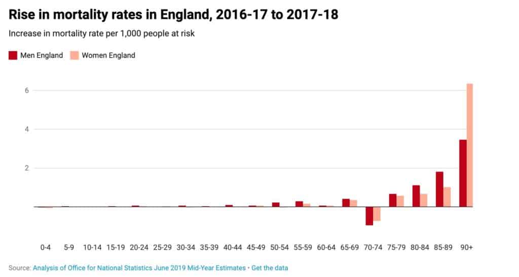 Interestingly my age group is still doing OK as you can see from the above chart.
As the article says:
Warnings for the future
Something is going very wrong. And whatever is going on is unique to the UK because in no other European country have there been overall falls in life expectancy that look at all like this. The figures for Scotland, Wales and Northern Ireland are almost certainly as bad as England, but no one has as yet bothered to study them in any detail – let alone tried to work out where they are heading.
Very interesting the full article is here